More actions
इससे बड़ा रेसोल्यूशन उपलब्ध नहीं हैं।
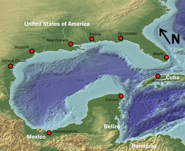
Fixed_gulf_map.png (७३४ × ६०० चित्रतत्व, संचिका का आकार: १,००१ KB, माइम प्रकार: image/png)
सारांश
| विवरण |
English: The Gulf of Mexico as a 3D relief map, showing both water depth and land elevation. |
| स्रोत | Source (High-Res: 3000x2451) |
| लेखक | NOAA |
| अनुमति (इस चित्र का पुनः उपयोग करना) |
Public domain |
| दूसरे संस्करण |
 |
लाइसेंस
This image is in the public domain because it contains materials that originally came from the U.S. National Oceanic and Atmospheric Administration, taken or made as part of an employee's official duties.
|
चित्र का इतिहास
चित्र पुराने समय में कैसी दिखती थी यह जानने के लिए दिनांक/समय पर क्लिक करें।
| दिनांक/समय | थंबनेल | आकार | सदस्य | टिप्पणी | |
|---|---|---|---|---|---|
| वर्तमान | १२:०७, ४ मई २०१० | | ७३४ × ६०० (१,००१ KB) | wikimediacommons>GatorSlayerFSU | {{Information |Description={{en|1=Fixed the gap in pic}} |Source=Public Domain |Author=GatorSlayerFSU |Date=5/4/10 |Permission= |other_versions= }} |
चित्र का उपयोग
यह पृष्ठ इस चित्र का इस्तेमाल करता है: