More actions
मूल चित्र (९६२ × ७४१ चित्रतत्व, संचिका का आकार: ९४ KB, माइम प्रकार: image/jpeg)

|
इस locator map चित्र को वेक्टर ग्राफ़िक्स की मदद से एक SVG फ़ाइल के रूप में पुनः निर्मित किए जा सकते हैं। इसके कई फ़ायदे हैं; अधिक जानकारी के लिए Commons:Media for cleanup देखें। अगर इस चित्र का एक SVG रूप उपलब्ध है, कृपया उसे अपलोड करें और उसके बाद इस साँचे को
{{vector version available|नए चित्र का नाम}} से बदल दें।
SVG फ़ाइल का नाम "Spratly with flags.svg" रखना अनुशंसित है—ऐसा करने पर Vector version available (या Vva) साँचे पर नए चित्र का नाम वाले पैरामीटर की ज़रूरत नहीं पड़ेगी। |


| विवरण |
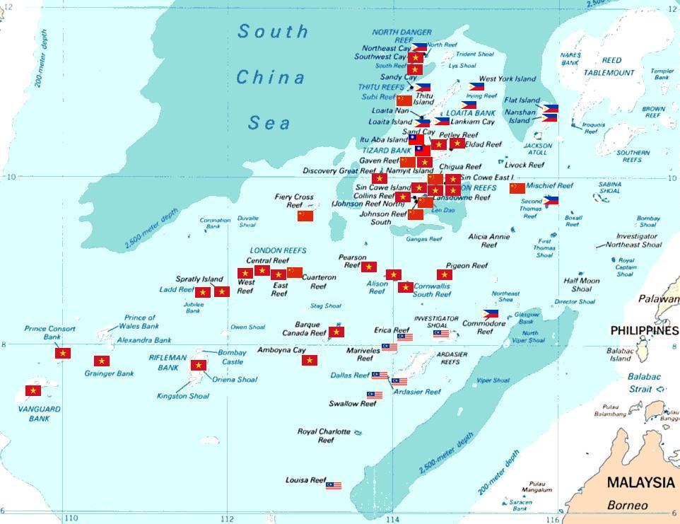
Spratly islands map showing occupied features marked with the flags of countries occupying them.
Kennan Reef (C) The flag nearest the flag for Johnson South Reef (C). |
||||||
| दिनांक | (Original Picture), February 3, 2008 (Modified Picture) | ||||||
| स्रोत | Central Intelligence Agency. | ||||||
| लेखक | CIA. Cropped and Flags added by Estarapapax. | ||||||
| अनुमति (इस चित्र का पुनः उपयोग करना) |
|
||||||

चित्र का इतिहास
चित्र पुराने समय में कैसी दिखती थी यह जानने के लिए दिनांक/समय पर क्लिक करें।
| दिनांक/समय | थंबनेल | आकार | सदस्य | टिप्पणी | |
|---|---|---|---|---|---|
| वर्तमान | १३:३८, २५ मार्च २००८ | | ९६२ × ७४१ (९४ KB) | wikimediacommons>KAVO | {{Information |Description=Spratly islands map showing occupied features marked with the flags of countries occupying them. <br>{{flagicon|Philippines}} Philippines <br>{{flagicon|Taiwan}} Taiwan <br>{{flagicon|Vietnam}} Vietnam <br>{{flagicon|Malaysia}} |
चित्र का उपयोग
यह पृष्ठ इस चित्र का इस्तेमाल करता है: