चित्र:Al-Idrisi's world map.JPG
मूल फ़ाइल (१,४२४ × १,५५२ पिक्सेल, फ़ाइल का आकार: ९१७ KB, MIME प्रकार: image/jpeg)
|


सारांश
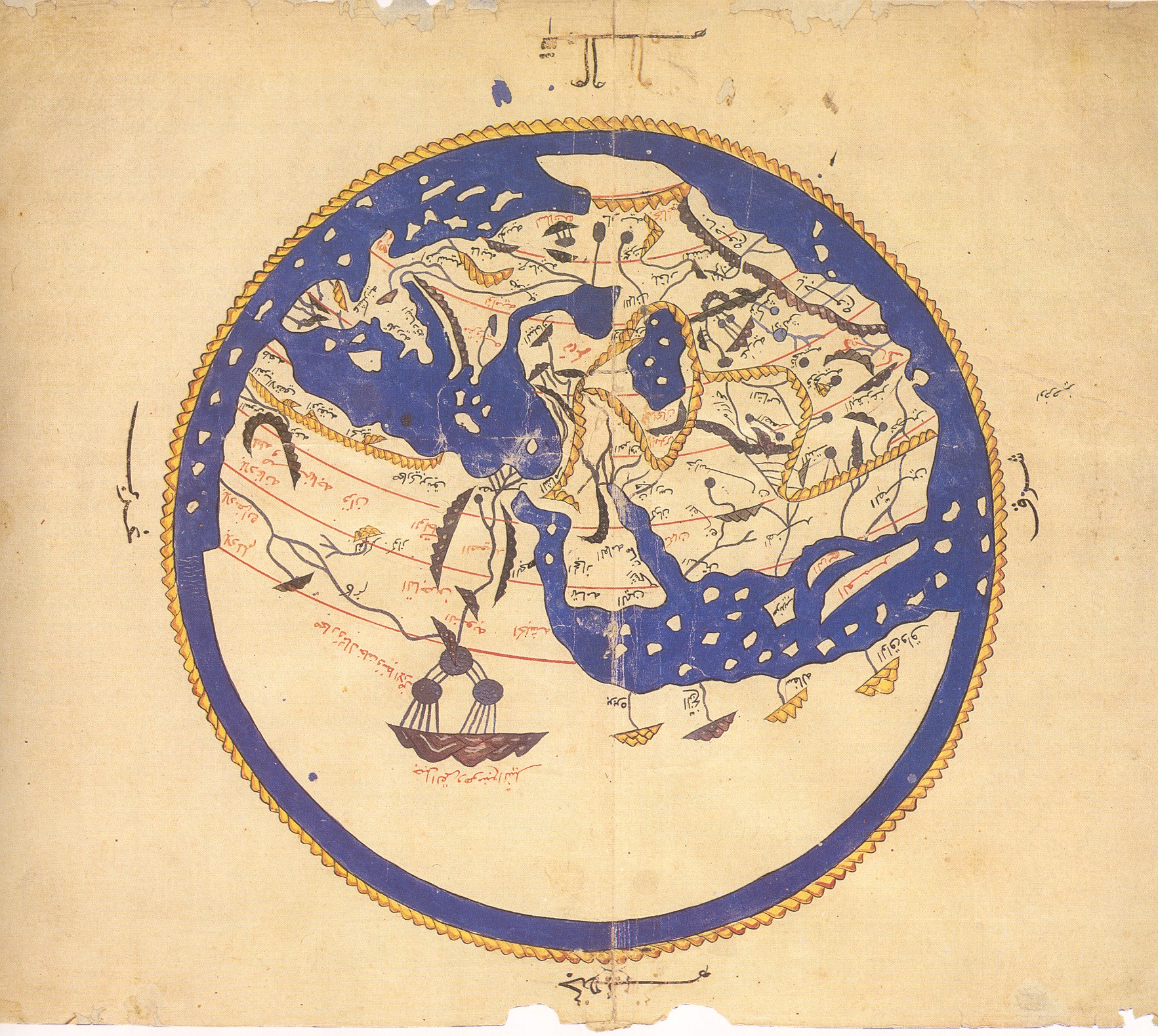
لاحظ كيف أنَّ الجنوب وُضع أعلى الخارطة.
- الخريطة معكوسة حيثُ أنَّ الجنوب في الأعلى
- في الملكيَّة العامَّة كونها قديمة لا تخضع لحقوق التأليف والنشر.
أُخذت النسخة الأولى من هذا الموقع، وتحديدًا من هُنا. أمَّا النسخة الثانية فقد تمَّ قلبها وقصَّها، وأصلها هُنا
وفقًا لمكتبة فرنسا الوطنيَّة، فإنَّ هُناك عشرُ نُسخٍ باقية من كتاب نزهة المشتاق في اختراق الآفاق أو كتاب روجر حول العالم. ومن بين هذه النُسخ العشر، فإنَّ ستَّة تضم خارطة مُستديرة في بداية المؤلَّف غير مذكورة في نص الإدريسي الأصلي". [1]
هذه الصورة مأخوذة من مخطوطة نسخها علي بن الحسن الحوفي القاسمي في القاهرة سنة م1456، يُحتفظُ بها الآن في مكتبة بودليايان بأكسفورد. (Mss. Pococke 375 fol. 3v-4)
مُلاحظة: الخارطة في الأعلى مغلوطة ومقلوبة رأسًا على عقب.
فلا تتشاطرها مع أحد عبر أي موقع أو في الواقع، واستبدلها بهذه النسخة
Note that south is at the top of the map.
The first version was uploaded from Henry Davis; the second rotated and cropped from an original at Sindominio.net. The original image is also available at the Bodleian here.Versions
-
 Rotated 180 degrees
 -
 Original picture.
 -
 This version (cropped).
 -
 More cropped.
 -
 Wikimedia user awards
 -
 English and Latin version.


लाइसेंस
|
This is a faithful photographic reproduction of a two-dimensional, public domain work of art. The work of art itself is in the public domain for the following reason:
The official position taken by the Wikimedia Foundation is that "faithful reproductions of two-dimensional public domain works of art are public domain".
This photographic reproduction is therefore also considered to be in the public domain in the United States. In other jurisdictions, re-use of this content may be restricted; see Reuse of PD-Art photographs for details. | |||||


Captions
फ़ाइल का इतिहास
फ़ाइल पुराने समय में कैसी दिखती थी यह जानने के लिए दिनांक/समय पर क्लिक करें।
| दिनांक/समय | अंगूठाकार | आकार | सदस्य | टिप्पणी | |
|---|---|---|---|---|---|
| वर्तमान | ०९:२३, २३ अगस्त २००६ | अंगूठाकार बनाने में त्रुटि हुई: फ़ाइल गायब है | १,४२४ × १,५५२ (९१७ KB) | smartcommons>Leinad-Z~commonswiki | Losslessly rotaded and cropped from http://www.sindominio.net/labiblio/varios/IdrisiMap.jpg |
चित्र का उपयोग
2 ये पृृष्ठ इस चित्र का इस्तेमाल करते हैं:
