चित्र:BRA orthographic.svg

इस SVG फ़ाइल के PNG पूर्वावलोकन का आकार: २२० × २२० पिक्सेल। दूसरा रेसोल्यूशन: २४० × २४० पिक्सेल।
मूल फ़ाइल (SVG फ़ाइल, साधारणतः ८०२ × ८०२ पिक्सेल, फ़ाइल का आकार: ९.७२ MB)
सारांश
English: This map (in {ISO} orthographic.svg format) is part of the Spanish Wikipedia style conventions. Please do not edit unless a consensus has been reached on the Spanish Wikipedia. If the conventions of other wikis are violated, upload an alternative version or use other available maps.
Español: Este mapa (en formato {ISO} orthographic.svg) forma parte de las convenciones de estilo de Wikipedia en español. Por favor, no editar a menos que se haya llegado a un concenso en Wikipedia en español. En caso de que se incumplan convenciones de otras wikis, subir una versión alternativa o usar otros mapas disponibles.
| विवरणBRA orthographic.svg |
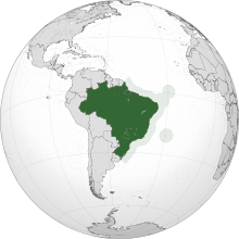
English: A map of the hemisphere centred on -14°, -54°, using an orthographic projection. Brazil is highlighted in green. Solid areas represent sovereign territories. In the exclusive economic zone (EEZ) the state does not have full sovereignty, but rather "sovereign rights". Dashed areas represent disputed territories or unrecognized territories.
Sources:
Software used: Español: Mapa del hemisferio centrado en -14°, -54°, usando una proyección ortográfica. Brazil está resaltado en verde. Los colores sólidos representan territorios soberanos. En las zonas económicas exclusivas (ZEE) el estado no tiene soberanía absoluta, pero tiene "derechos de soberanía". Las áreas discontinuas representan territorios en disputa o no reconocidos.
Fuentes:
Software usado: |
| दिनांक | |
| स्रोत | अपना कार्य |
| लेखक | David Ayala |
| SVG genesis InfoField |  and with QGIS. and with QGIS. |




लाइसेंस
मैं, इस कार्य का/की कॉपीराइट धारक, इसे निम्न लाइसेंस के अंतर्गत प्रकाशित करता/करती हूँ:


इस फ़ाइल को क्रिएटिव कॉमन्स श्रेय-समानसांझा 3.0 अनांतरित लाइसेंस के अंतर्गत लाइसेंस किया गया है।
- आप खुलकर:
- बाँट सकते हैं – रचना की प्रतिलिपि बना सकते हैं, बाँँट सकते हैं और संचारित कर सकते हैं
- रीमिक्स कर सकते हैं – कार्य को अनुकूलित कर सकते हैं
- निम्नलिखित शर्तों के अंतर्गत:
- श्रेय – यह अनिवार्य है कि आप यथोचित श्रेय प्रदान करें, लाइसेंस की कड़ी प्रदान करें, और अगर कोई बदलाव हुए हों तो उन्हें इंगित करें। आप ऐसा किसी भी उचित तरीके से कर सकते हैं, लेकिन किसी भी तरह उससे यह नहीं संकेत नहीं किया जाना चाहिए कि लाइसेंसधारी द्वारा आपको अथवा आपके इस प्रयोग का समर्थन किया जा रहा हो।
- समानसांझा – यदि आप सामग्री को रीमिक्स करते हैं, बदलते हैं, या उस पर आधारित कुछ बनाते हैं, तो आपको अपने योगदान को समान या संगत लाइसेंस के तहत वितरित करना होगा।
Captions
Add a one-line explanation of what this file represents
Orthographic map of Brazil
Mapa do hemisfério centralizado em –54, –14, com o uso de projeção ortográfica.
Um mapa do hemisfério central em -54, -14, usando uma projeção ortográfica.
БРАЗИЛИЯ
==}}acesso bloqueado 🚫 com sucesso}}==
==}}acesso bloqueado 🚫 com sucesso}}==
Globe terrestre avec le Brésil en vert, et ses eaux en vert pâle.
फ़ाइल का इतिहास
फ़ाइल पुराने समय में कैसी दिखती थी यह जानने के लिए दिनांक/समय पर क्लिक करें।
| दिनांक/समय | अंगूठाकार | आकार | सदस्य | टिप्पणी | |
|---|---|---|---|---|---|
| वर्तमान | ०७:३२, १४ अप्रैल २०२६ |  | ८०२ × ८०२ (९.७२ MB) | smartcommons>User7778 | Reverted to version as of 00:21, 17 July 2025 (UTC) |
चित्र का उपयोग
कोई भी ऐसा पृष्ठ नहीं है जो इस चित्र का प्रयोग कर रहा हो।
