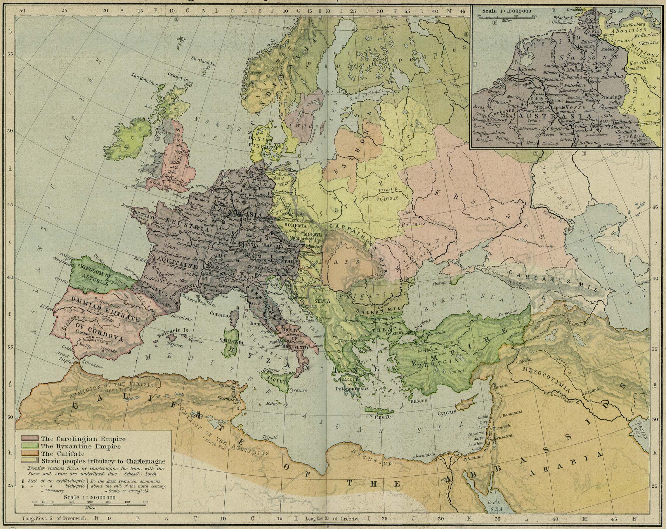
चित्र:Byzantine Empire 814.svg

इस SVG फ़ाइल के PNG पूर्वावलोकन का आकार: २२० × १६७ पिक्सेल। दूसरा रेसोल्यूशन: ३१६ × २४० पिक्सेल।
मूल फ़ाइल (SVG फ़ाइल, साधारणतः ५०० × ३८० पिक्सेल, फ़ाइल का आकार: ७५३ KB)
सारांश

.svg)


.svg)
.svg)
.svg)
.svg)
.svg)


.svg)
.svg)
.svg)


.png)
.png)


.svg)


.svg)

.svg)


.svg)
.svg)
.svg)
.svg)


.svg)
.png)


.svg)


.svg)
.svg)


.svg)


.svg)



.png)
.svg)
.svg)
.svg)


.svg)


.svg)
.svg)
.svg)


_cropped.svg)
.svg)
.svg)
.svg)
.svg)


.svg)
.svg)
.svg)
.svg)
.svg)
.svg)


.svg)
.svg)
.svg)
.svg)

.svg)
.svg)
.svg)
.svg)
.svg)
.svg)
.svg)
.svg)

.svg)


.svg)
.svg)
.svg)

.svg)

.svg)

.svg)
.svg)
.svg)
.svg)
.svg)
.svg)
.svg)
.svg)
.svg)
.svg)
.svg)
.svg)
.svg)

.svg)
.svg)
.svg)


.svg)

लाइसेंस


इस फ़ाइल को क्रिएटिव कॉमन्स श्रेय-समानसांझा 4.0 अंतर्राष्ट्रीय लाइसेंस के अंतर्गत लाइसेंस किया गया है।
- आप खुलकर:
- बाँट सकते हैं – रचना की प्रतिलिपि बना सकते हैं, बाँँट सकते हैं और संचारित कर सकते हैं
- रीमिक्स कर सकते हैं – कार्य को अनुकूलित कर सकते हैं
- निम्नलिखित शर्तों के अंतर्गत:
- श्रेय – यह अनिवार्य है कि आप यथोचित श्रेय प्रदान करें, लाइसेंस की कड़ी प्रदान करें, और अगर कोई बदलाव हुए हों तो उन्हें इंगित करें। आप ऐसा किसी भी उचित तरीके से कर सकते हैं, लेकिन किसी भी तरह उससे यह नहीं संकेत नहीं किया जाना चाहिए कि लाइसेंसधारी द्वारा आपको अथवा आपके इस प्रयोग का समर्थन किया जा रहा हो।
- समानसांझा – यदि आप सामग्री को रीमिक्स करते हैं, बदलते हैं, या उस पर आधारित कुछ बनाते हैं, तो आपको अपने योगदान को समान या संगत लाइसेंस के तहत वितरित करना होगा।
Captions
Add a one-line explanation of what this file represents
फ़ाइल का इतिहास
फ़ाइल पुराने समय में कैसी दिखती थी यह जानने के लिए दिनांक/समय पर क्लिक करें।
| दिनांक/समय | अंगूठाकार | आकार | सदस्य | टिप्पणी | |
|---|---|---|---|---|---|
| वर्तमान | ००:४२, २५ मई २०१६ |  | ५०० × ३८० (७५३ KB) | smartcommons>Alphathon | == {{int:filedesc}} == {{Inkscape}} {{Information |Description={{en|A map map of the en:Byzantine Empire within Europe circa 814 CE.}} |Source= {{Derived from|Blank_map_of_Europe.svg|display=50}} '''Data source:''' http://www.lib.utexas.edu/maps... |
चित्र का उपयोग
कोई भी ऐसा पृष्ठ नहीं है जो इस चित्र का प्रयोग कर रहा हो।
