चित्र:IslamicConquestsIroon.png

इस पूर्वावलोकन का आकार: २२० × १९५ पिक्सेल। दूसरे रेसोल्यूशन्स: २७० × २४० पिक्सेल | १,००६ × ८९३ पिक्सेल।
मूल फ़ाइल (१,००६ × ८९३ पिक्सेल, फ़ाइल का आकार: १०५ KB, MIME प्रकार: image/png)

|
इस historical map चित्र को वेक्टर ग्राफ़िक्स की मदद से एक SVG फ़ाइल के रूप में पुनः निर्मित किया जा सकता है। इसके कई फ़ायदे हैं; अधिक जानकारी के लिए Commons:Media for cleanup देखें। अगर इस चित्र का एक SVG रूप उपलब्ध है, कृपया उसे अपलोड करें और उसके बाद इस साँचे को
{{vector version available|नए चित्र का नाम}} से बदल दें।
SVG फ़ाइल का नाम "IslamicConquestsIroon.svg" रखना अनुशंसित है—ऐसा करने पर Vector version available (या Vva) साँचे पर नए चित्र का नाम वाले पैरामीटर की ज़रूरत नहीं पड़ेगी। |
| विवरणIslamicConquestsIroon.png |
English: Map of the Sassanid, Byzantine and Muslim borders. |
| स्रोत | File:Pre_Islamic_Arabia.PNG |
| लेखक | Javierfv1212 and edited by HistoryofIran. |
| दूसरे संस्करण |
[]
|


| Public domainPublic domainfalsefalse |

|
This file is in the public domain because File:Pre_Islamic_Arabia.PNG
|


Captions
Add a one-line explanation of what this file represents
Map of the Sassanid and Byzantine Empires, and the Rashidun Caliphate
फ़ाइल का इतिहास
फ़ाइल पुराने समय में कैसी दिखती थी यह जानने के लिए दिनांक/समय पर क्लिक करें।
| दिनांक/समय | अंगूठाकार | आकार | सदस्य | टिप्पणी | |
|---|---|---|---|---|---|
| वर्तमान | १५:४३, १८ सितम्बर २०१९ | 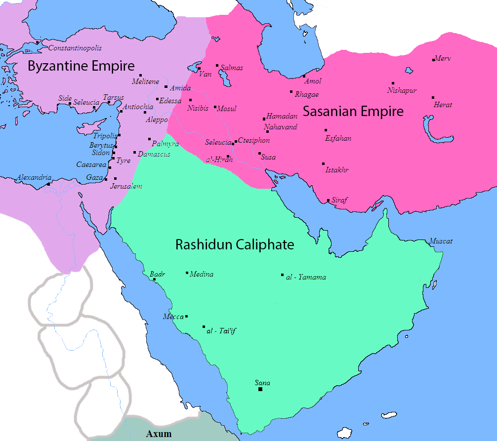 | १,००६ × ८९३ (१०५ KB) | smartcommons>HistoryofIran | rv, thats not how it works |
चित्र का उपयोग
कोई भी ऐसा पृष्ठ नहीं है जो इस चित्र का प्रयोग कर रहा हो।
